
Geospatial & Photogrammetric Solutions:
Smarter Data for Smarter Planning
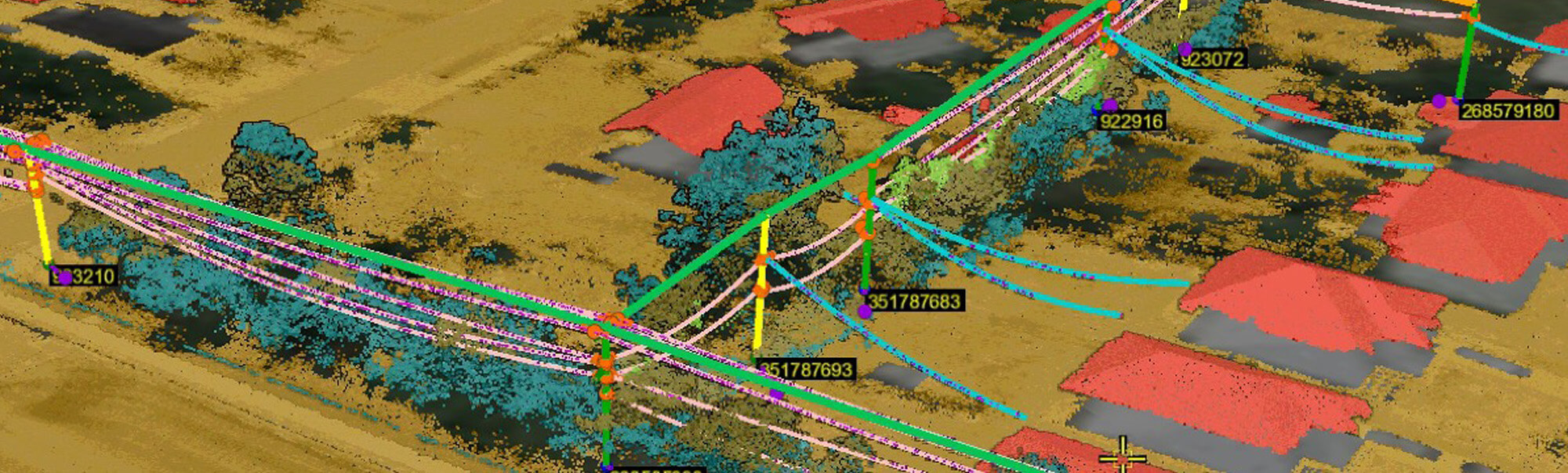
Our geospatial solutions turn raw data into actionable intelligence, enabling civil engineers, planners, and power utilities to design, analyze, and manage complex infrastructure systems with confidence.
Co-Collected Data for Deeper Insights
Because we capture LiDAR, nadir and oblique imagery, and survey data together, we provide unmatched analytical possibilities, including:
- Change detection for infrastructure monitoring – Compare past and current datasets to assess degradation, settlement, structural movement or contractor compliance.
- Integrated terrain and asset mapping – Simultaneously analyze elevation models, vegetation encroachment, and infrastructure assets.
- Multi-use data for different stakeholders – A single dataset can support engineering, urban planning, and energy sector analysis.
Photogrammetry & High-Resolution Imagery
Our photogrammetric solutions provide highly detailed mapping for:
- Urban & transportation planning – Supporting corridor design, road expansions, and zoning assessments.
- Power & utility infrastructure – Identifying potential maintenance issues, encroachment risks, and asset conditions.
- Environmental analysis – Tracking land use, erosion, and ecological changes with multispectral imaging.
Terrestrial LiDAR for Precision Mapping
Our ground-based LiDAR scanning captures the finest details of infrastructure and site conditions, making it ideal for:
- Structural & facilities documentation – Accurately measuring industrial plants, power stations, and large-scale infrastructure.
- As-built verification – Ensuring construction projects match design specifications.
- Transportation & transit systems – Mapping roadways, rail lines, and tunnels with millimeter precision.
With co-collected datasets and integrated analysis, we help clients streamline workflows, reduce costs, and future-proof their projects.