
Data that Does More.
Making geospatial survey grade data Accessible, Affordable, Accurate and Recurring for all.

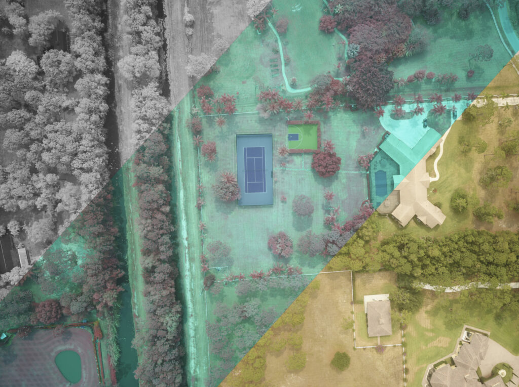
Since 2015, SMG has perfected a proprietary, scalable, multi-modal method of collecting geospatial data about the earth and everything on it. Using manned aircraft instead of drones, SMG’s “low and slow” approach allows for the best of both drone and commercial aviation to collect data at scale. All DARIUS data is collected simultaneously, creating a single source of truth for geographically referenced survey grade data for layered insights.
Capture Methodology
- Highest Fidelity Multimodal Data Collection, Everytime
- 3cm RGB and CIR Ground Resolution
- 100+ points per square meter LiDAR
- Survey Quality Level 0 or below (5cm RMSExyz)
- Multimodal: LiDAR, RGB, CIR, Thermal, 4G/5G Mapping
- Survey Grade Quality Control
- Full State Coverage for Digital Twins
- Power Utilities
- Water Management
- Solar and Wind Generation
- Rail
- Transportation
- On-Demand, On-Schedule
- 6 month refresh for urban areas and 1 year refresh for rural
- DARIUS Pre-Classified Insights
- All territories are pre-classified with ground, buildings, high and low vegetation already classified
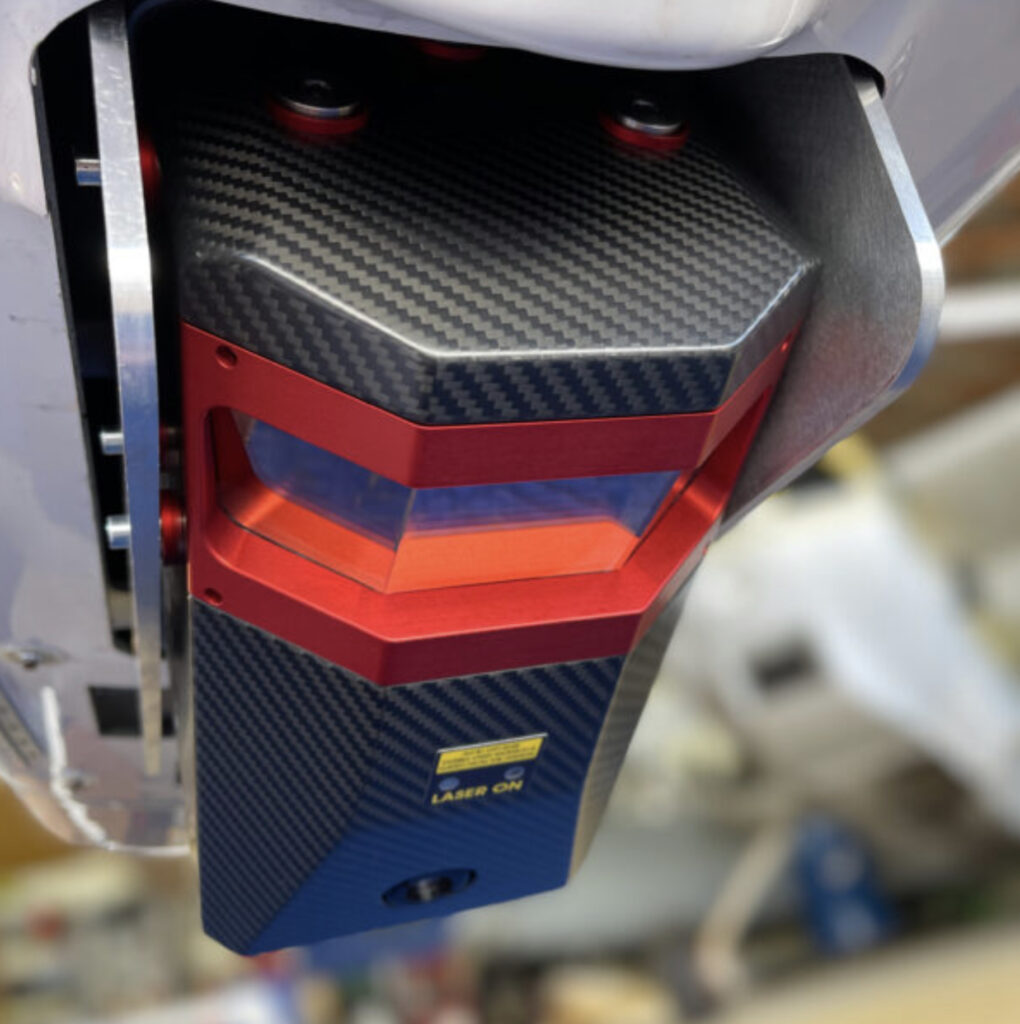
Capture Technology
DARIUS exclusively utilizes Riegl – the best LiDAR sensors in the world. While the standard is up to 25 points per square meter, SMG’s sensors capture up to 200. This makes survey quality level 0 or below (5cm RMSExyz) attainable.

Flying Phase One’s latest 4-Band Solution, SMG captures 4-Band RGBN TIFF files, 3-Band NRG TIFF files, NDVI TIFF Files as well as standard 150mp RGB files. This resolution combined with SMG’s low and slow approach offers unprecedented detail. These sensors capture industry-leading photogrammetry deliverables and colorize our LiDAR point clouds and ultra-high resolution orthomosaics.
Oblique 60+mp Camera
In addition to flying a Phase One, SMG also flies a suite of 60+mp mirrorless cameras with telephoto lenses. These capture drone quality images while flying well above drone height and flying far enough to capture far-ranging assets in a single flight.
SMG is changing how the US thinks about sourcing data.